WESTFIELD-A report recently released by the Izaak Walton League of America (IWLA) says water quality monitoring in streams across the country is “haphazard and limited,” adding it leaves Americans in the dark about the health of local waters – and potentially leaving pollution undetected.
The national report notes it conducted an “extensive investigation” into stream monitoring practices and water pollution problems in all 50 states and uncovered “startling” results, including:
- Analysis shows states are effectively monitoring water quality in only two percent of rivers and streams nationwide.
- Based on state reports to the U.S. Environmental Protection Agency (EPA), more than half (55%) of the streams and rivers in states tested were not safe for designated uses such as swimming, fishing, and as sources of drinking water.
- Pollutants in these waters include a laundry list of bacteria, carcinogens, and nutrients.
- Testing sites are often randomly located and limited in number, and most information about water quality in streams is 5- to 10-years-old.
- More than half of all states (26) received “D” or “F” grades for the overall effectiveness of the state’s stream monitoring efforts.
The full report, including state-by-state grading, can be viewed at www.iwla.org/righttoknow.
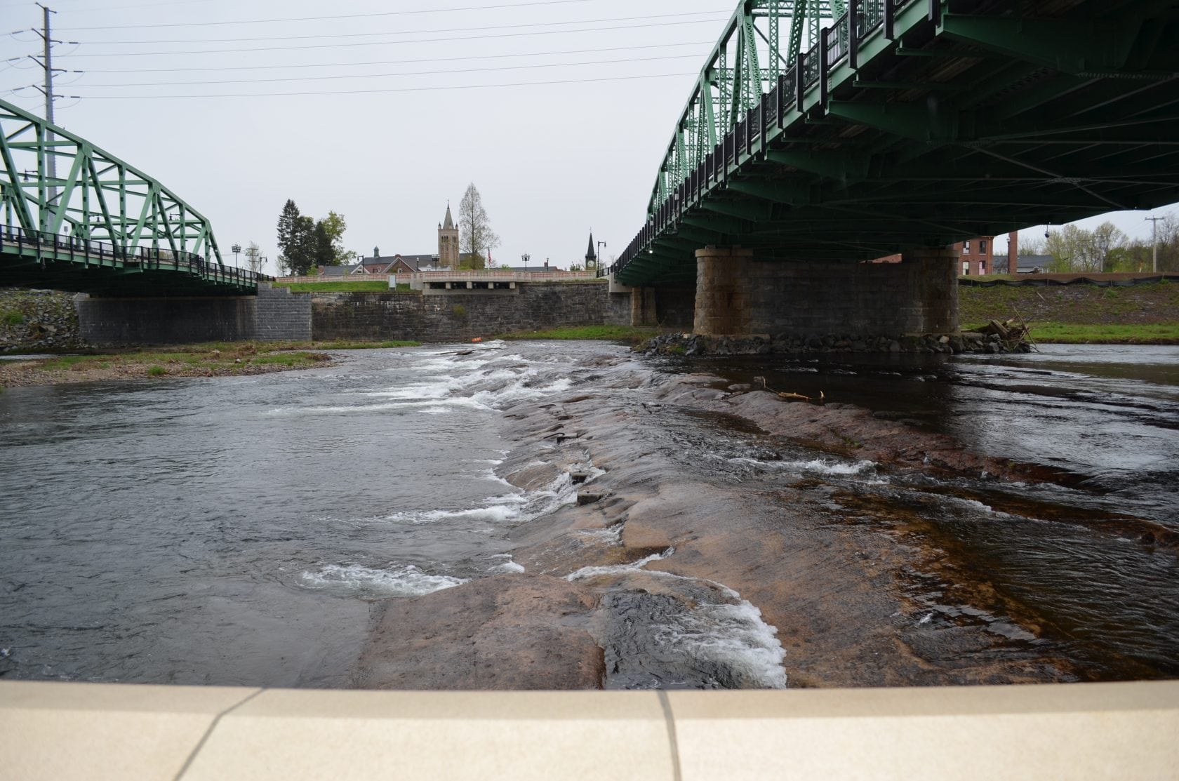
A view of the Westfield River from Half Mile Falls Park.
“There is an alarming lack of timely information about water quality in this country,” said IWLA Executive Board Chair Jodi Arndt Labs. “Every morning, you can read about that day’s air quality in the local paper or on your smart phone, yet information about the health of local streams is 5- to 10-years-old. That’s a problem.”
The Clean Water Act of 1972 requires states to monitor the safety of all waterways, report water quality information publicly every two years, and address pollution problems. The IWLA found that many states have weak water quality standards that can inflate the number of waters rated clean and healthy – and most states don’t monitor water quality often enough to make accurate statewide safety claims.
The Izaak Walton League has a solution to this problem – empowering citizens to collect scientifically valid water quality data (and ensuring states use this data more effectively).
“Across the country today, League chapters and networks of citizen monitors are already doing great work,” said IWLA Executive Director Scott Kovarovics. “Volunteers could regularly monitor water quality in thousands more streams and provide timely results to their neighbors and state governments. The League is committed to achieving this goal by getting more citizens involved in stream monitoring nationwide.”
The Izaak Walton League was founded in 1922 to conserve America’s natural resources – including soil, air, woods, waters and wildlife – for future generations. Today, League priorities include engaging youth in the outdoors, restoring and conserving habitat for fish and wildlife, and ensuring America’s streams, rivers, and other waters are clean and safe.
The report said Massachusetts residents “have much to be concerned about when it comes to water pollution,” citing pollutants found in waterways include bacteria, PCBs (a probable carcinogen), mercury, and pesticides, nutrients that spur algae growth, and sediment that chokes fish and other aquatic life.
A breakdown of Massachusetts’ findings, with an overall rating of “D,” included:
- State reports 28 percent of streams tested. The IWLA fact check said that only four percent of streams are tested. “To adequately assess water quality, the state needs a significant increase in permanent monitoring stations, where data is collected each year at the same place,” notes IWLA.
- Massachusetts has more than 12,000 miles of streams and rivers and 20 permanent monitoring stations. “The U.S. EPA recommends a maximum of 25 miles per station. The number of permanent stations needed in Massachusetts is actually 502,” notes IWLA.
- State reports 36 percent of streams are clean. The IWLA fact check notes “Not only does the state need to monitor hundreds more sites to adequately and accurately assess water quality, it has uneven water quality standards and uses out-of-date information. So the state’s claim that even 36 percent of its streams and rivers are clean and healthy smells a little fishy.”
With an overall “D” rating cited, the Westfield News recently requested the most current information about the Greater Westfield area from the Division of Watershed Management, Massachusetts Department of Environmental Protection (MassDEP).
“The Westfield River was selected for study in the summer of 2012 to inform the nutrient management plan being developed as part of the Massachusetts Surface Water Quality Standards,” said Arthur S. Johnson, DWM Environmental Monitoring Program, MassDEP, in a written statement. “Previous data suggested that the Westfield River was impaired by blooms of filamentous algae while exhibiting low average concentrations of total phosphorus in the water column.”
Johnson noted that several sites on the Westfield River, including some upstream tributaries, were selected for sampling of water and periphyton.
Westfield River Watershed sites that were sampled in 2012 to support nutrient criteria development were:
- Westfield River, West Branch, approximately 920 meters upstream/northwest from Route 112, Huntington.
- Westfield River, east of Route 20, approximately 530 feet downstream from the Route 90 crossing, just over the Russell border, Westfield.
- Westfield River, north of Shepard Street and the Whitney Playground, Westfield.
- Westfield River, upstream Westfield Pollution Control Plant, near sewer crossing, Westfield.
- Little River, Route 20 bridge, Westfield.
- Westfield Water Pollution Control Plant, outfall, Westfield.
- Westfield River, north of Ascutney Avenue, Westfield.
- Westfield River, approximately 1,200 feet upstream of Route 20, East Main Street, Westfield.
The Westfield River Watershed encompasses 517 square miles in Hampden, Hampshire, and Berkshire counties. The Westfield River is a major tributary to the Connecticut River and is made up of three branches: East, Middle, and West. The East Branch begins in the towns of Windsor and Savoy, the Middle Branch in Peru, and the West Branch has its headwaters in Washington. The three branches converge in Huntington to form the Main Branch, which flows in a southerly direction for 27 miles.
“Data from the 2012 survey are still undergoing validation and, to date, have not been used for assessment purposes,” said Johnson.
Johnson also noted that the MassDEP’s surface water monitoring program implemented a new, statistically valid sampling design in 2010 for shallow streams.
“While making up the vast majority of river miles in the Commonwealth, many of these headwater streams and small tributaries to main stream rivers had not been monitored in the past, and a probabilistic design was chosen to provide an estimate of the condition of those waterbody areas,” said Johnson.
The goals of the monitoring program were to provide an unbiased assessment of the aquatic life, recreational aesthetic uses in wadable, non-tidal perennial streams of Massachusetts, and, over time, to provide an analysis of trends in the use status of those streams, according to Johnson.
Sites in the Westfield Watershed that were monitored in 2012 as part of the statewide probabilistic survey of wadable streams included: Great Brook and Munn Brook, Westfield; Westfield River, Cummington; Webster Brook and West Branch, Chesterfield; Middle Branch, Westfield River/West Branch, Huntington; Westfield River, Savoy; Pond Brook, Blandford; Westfield River/West Branch, Middlefield/Becket; Westfield River/Middle Branch, Worthington, and Billings Brook, Plainfield.
“Monitoring activities included habitat assessment, macroinvertebrate and fish population assessments, and physiochemical sampling,” said Johnson.
Following additional survey monitoring across the state through 2015, MassDEP is planning a statistically valid survey of Massachusetts’ lakes and ponds, according to Johnson.
“A survey of approximately 75 lakes and ponds in Massachusetts will be initiated in 2016 and will likely be completed over a period of three years,” said Johnson.
Johnson noted that lakes in the Westfield Watershed that will be sampled this year include Pequot Pond at Kingsley Beach, Westfield; Congamond Lakes, South Basin, Southwick; Robin Hood Lake and Buckley-Dunton Lake, both Becket, and Damon Pond, Chesterfield.
Johnson also noted that the U.S. EPA encourages states to identify waters impaired by “nonpoint source pollution” that have been the focus of restoration activities, and perform monitoring to demonstrate resulting improvements.
“MassDEP is also planning section 319 effectiveness monitoring at the middle basin at Congamond Lake in 2016,” said Johnson.
The IWLA report urged Massachusetts officials to expand engagement with volunteer stream monitors and more effectively use the data they collect to ensure the public has accurate, timely, and site-specific information about water quality in streams and rivers statewide.
“Volunteers can help close the gaps in public knowledge about the health and safety of Massachusetts’ rivers and streams and can move the state closer to actually monitoring all of its waterways,” cited the report.
Bill Rose, president of the Westfield River Watershed Association, said that its board members cannot monitor all of the Westfield River Watershed for problems or situations.
“We rely on residents in towns within the watershed to contact board members with concerns,” said Rose. “We then follow-up and get back to the person on our results and action. In the past and present this is an effective way to monitor the whole watershed.”
Rose added that the association hired an intern from Westfield State University, under the supervision of board member Aaron Reyes, Ph.D., who tested five sites in August and September. Reyes is an assistant professor of chemical and physical science at Westfield State.
“They finished compiling their data and made a chart in March of this year,” said Rose, noting the results were not sent to the state.
“We were in fact waiting for a report from the EPA that was done in 2011-2012 that was monitoring the Westfield River. Upon initial review of the EPA report, their results were almost identical to ours.”
Rose said the association plans to hire another Westfield State intern for the end of this summer and fall to monitor the river in the same areas that were done previously.
For area residents interested in getting involved with our local waterways, the Westfield River Watershed Association welcomes new members. Throughout the year, the organization offers symposiums, lectures, field trips and special events that encourage stewardship for the watershed and the river. For more information, visit www.westfieldriver.org.
The IWLA also provides free tools – including training videos, data forms, equipment lists, and a new biological monitoring mobile app – to help volunteers get started with water quality monitoring. The free tools are available at www.iwla.org/sos.
