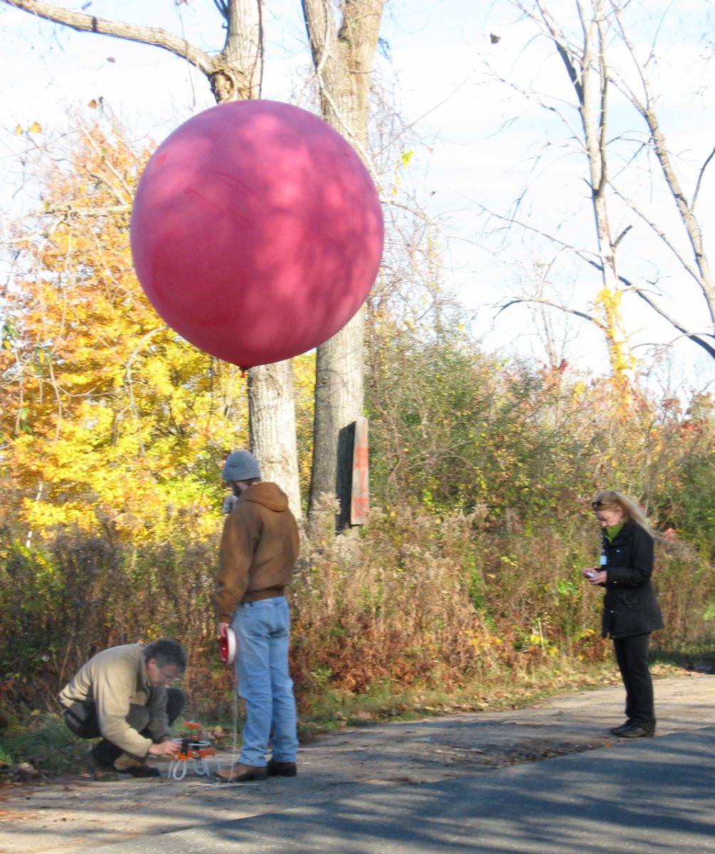
Professor Charles Schweik, Phd., of the University of Massachusetts, Amherst, programs a camera attached to a five-foot-diameter helium balloon held by Environmental Conservation graduate student Anthony Volpini as Westfield Conservation Coordinator Karen Leigh looks on yesterday morning on Root Road. (Photo by Dan Moriarty)
WESTFIELD – Conservation Coordinator Karen Leigh is preparing to do battle next spring against a foe which spreads quickly so she called upon the University of Massachusetts Center for Public Policy and the Environmental Conservation Department for assistance.
The foe is the Water Chestnut plant, which is a non-native, invasive species. The rapidly growing plant was reported to the city’s Conservation Department by a fisherman who recognized the threat posed by the aquatic plant whose dense mat blocks sunlight and changes the subsurface water environment.
Leigh called upon the university to help provide intelligence needed to launch an assault of volunteers in kayaks to hand pick the invasive plant. Leigh asked UMass to help provide that information through an experimental aerial asset.
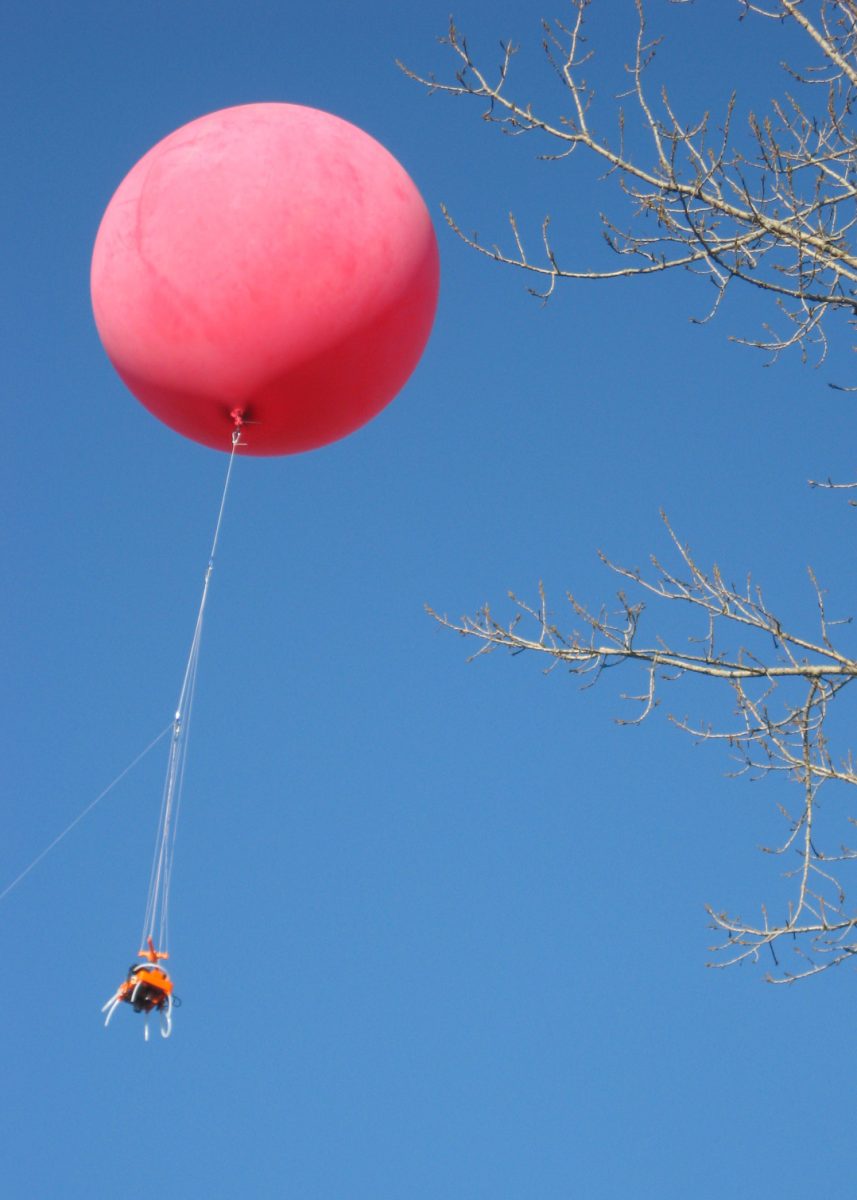
Professor Charles Schweik, PhD., of the Center for Public Policy and Administration, and Environmental Conservation graduate student Anthony Volpini provided aerial photographs of the Brickyard pond to the west of Root Road with a vehicle that caught the eye of early morning motorists, a five-foot-diameter red helium balloon.
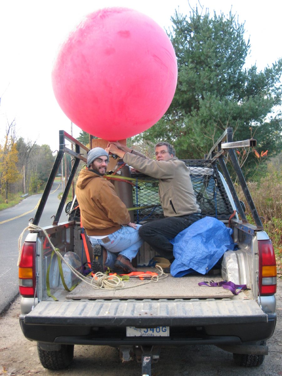
University of Massachusetts, Amherst, Environmental Conservation graduate student Anthony Volpini, left and Professor Charles Schweik of the Center for Public Policy and Administration prepare to launch a helium balloon to photograph the brickyard ponds west of Root Road yesterday morning. (Photo by Dan Moriarty)
Schweik had contacted the Air Traffic Control at Barnes Regional Airport because of the proximity of the Brickyard to the airport and was allowed to launch the balloon, but was given a 300-foot ceiling because of air traffic.
The helium balloon was tethered to a line and carried a platform equipped with two cameras, one that took full light spectrum color photographs and the other which took infrared photographs.
Schweik said that different species of plants give off different wavelengths of light in the infrared spectrum which, when fed into a computer, can be used to map the presence of specific species such as the invasive Water Chestnut plants.
Leigh said the plants are a threat because they can change the aquatic environment of the ponds. The Water Chestnut spreads quickly and the nuts can lie dormant up to a decade.
“The fact that the nuts can reproduce up to a decade means that you can remove the plants by handpicking and years later it’s back, so it a long-term control issue” Leigh said.
Schweik said the idea of the balloon camera platform came from efforts of environmental activists to map oil-caused damage to the Gulf of Mexico coast line following the BP Deepwater Horizon oil spill in April of 2010.
The environmentalists checked available satellite imagery, but it could not provide the detail needed to identify environmental damage.
“What they did was to build a camera platform attached to a kit pulled by a power board,” Schweik said. “They were able to map the oil damage to the entire coast.”
The technology was adjusted for use in locations where launching a board was not practical.
“This was developed as a lot-cost practical way to get aerial photographs,” Schweik said. “We’re trying to see if it can be applied for environmental conservation usage, as well.”
The photographic data collected yesterday will be downloaded into computers equipped with GSI and GPS technology for mapping, then sent to Leigh for planning the eradication of the invasive species.
