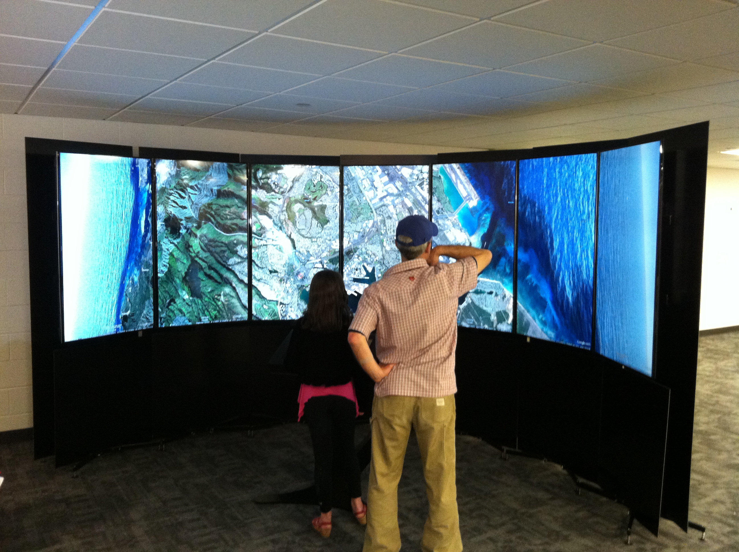
Westfield State Geography and Regional Planning Professor Dr. Carsten Braun shows a young patron how to use Google’s Liquid Galaxy in the Ely Library at WSU Wednesday. (Photo by Peter Francis)
WESTFIELD – It was a futuristic sight, as about a dozen students, faculty, and community members gathered around a cluster of screens on the second floor of the Ely Library at Westfield State University yesterday to behold a wonder of modern technology.
The wonder that lay before them, projected onto seven screens standing seven feet tall, is Liquid Galaxy, a revolutionary product developed by Google which utilizes the company’s Google Earth component to take users almost anywhere in seconds, on Earth or elsewhere.
“It sends Mars data, too,” said Tom Raffensperger, the dean of Academic Information Services at Westfield State. “There’s a rover up there taking pictures and mapping.”
Capable of showing off the red planet just as adeptly as taking users to Fenway Park, Liquid Galaxy’s potential is seemingly limitless, and Raffensperger says it will be available to the greater Westfield community during open lab times, after being made available professors and students first.
As the jaws of students and faculty alike dropped to the floor at the startling realism and accuracy of Google Earth’s mapping, professors in the school’s geography department took the opportunity to speak about the project, it’s humble beginnings, and what it means for the institution.
“It all started when Tim (LeDoux) and I were invited to attend the geospacial technology and higher education workshop at Google in California last summer,” said Dr. Carsten Braun, a professor of Geography and Regional Planning at the University. “When we saw the Liquid Galaxy we said ‘wow, this is cool, but not just cool – a great teaching tool.’ So when we came back, we launched an idea to (Dr.) Liz Preston and Tom Raffensperger saying ‘Hey, is this something we could get?’”
Various university departments collectively paid $25,000 to usie the program.
“It was really a collaborative effort,” said Raffensperger. “It was a lot of departments getting together. The library, we worked hard to make this space available, and the people at IT, academic information services, academic affairs, just a lot of different departments seeing how this would benefit the university as a whole.”
Raffensperger added that professors such as LeDoux will be using the program for introductory and advanced global imaging systems (GIS) courses to take students to distant cities.
“As a geographer and planner, I talk a lot about different cities and the issues they’re facing, such as Detroit with its bankruptcy,” LeDoux said. “I can talk a lot about the legacy – the racism, the disinvestment issues – and that helps students paint a picture, but to take them on the ground and walk through the neighborhoods of Detroit using this, they see it, the abandoned buildings, and it brings home the visual element to them.”
“I will be using this in my physical geography class, which is about landforms – glaciers, rivers, mountains, beaches – all kinds of stuff that. With this immersive program, you can experience beach erosion, experience sea level rise, much better than a static picture,” Braun said. “We can do labs and say ‘let’s go to the Grand Canyon, let’s look at what goes on at the intersection of land and ocean.’”
“(We’ll be) working with the folks from the Art Department, or any other interested people to create content experiences that they can use in their classes,” he added. “That’s what we’re going to be working on in the next few months. ‘You teach English Literature, you teach Art, let’s see how we can create activities that let students experience this in a special sense.’”
“This can be applied to all the different disciplines at the University,” LeDoux added. “Whether you’re trying to ground literature for students, poetry that a poet is writing about a landscape, it’s a very vivid image, but actually seeing what they’re writing about is very powerful.”
When asked about the prevalence of this technology, Braun was proud to admit that Liquid Galaxy is so far only available in museums and large research-based institutions, none of which are the size of Westfield State.
“I’d be super happy to talk to anybody about how to make this useful,” Braun said. “In a perfect world, we want to help everybody get this. But first, lets take this off the campus and bring it into the community, working in the local schools and make this a tool or experience that we share with the entire community.”
“We are very excited to be able to provide this,” said Westfield State University President Dr. Elizabeth Preston during the demo. “Part of the reason we decided to invest in the technology is because it’s very clear that it has applications for all kinds of disciplines beyond the obvious. So we’re very excited to have the technology on campus.”
