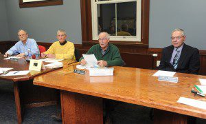
Conservation Commission members (from left) Thomas E. Sharp. James Murphy, Chairman David A. Doe and Henry Bannish listen to a resident during the public participation portion of their meeting Tuesday night. (Photo by Carl E. Hartdegen)
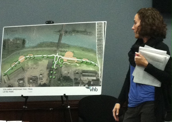
WESTFIELD – A presentation was given by City Engineer Mark Cresotti, assisted by Allary Braitsch, a senior wetlands scientist for Vanasse Hangen Brustlin, Inc. (VHB) to the city’s Conservation Commission on Tuesday night on a project that would construct a multi-use recreational trail connecting Sackett Street with Elm Street.
“This is the next effort toward the completion of the Columbia Greenway in the city of Westfield,” said Cresotti.
Cresotti informed the Commission that the Columbia Greenway has been broken up into three distinct phases within the city, with the southern-most phase having already been completed and funded by state grants.
“The north (phase) is about to be undertaken in the fiscal year 2016 and we’re fortunate to have another $2 million grant to improve Columbia Greenway central – from the river to East Silver Street to Main Street,” he said.
Cresotti said that, because of issues involving a proposed Greenway bridge over Main Street, the grant, which is time-sensitive and must be spent by June 30, will be utilized to fund the construction of what is now being referred to as the Westfield River Levee Enhancement.
“(The trail) is a principal connection that will be put up onto the levee,” he said. “It is used frequently (by residents). We’re looking to take the levee and enhance it with a 10-foot path.”
Cresotti indicated that the path will be lit and will provide residents with recreational opportunities.
“We’re looking to have some informational ammenities highlighting some of the historic elements distinct to this location,” he said, before turning the floor over to Braitsch, who presented the commission with some of the project’s nuts and bolts.
“It’s on top of the levee and is routinely mowed,” said Braitsch of the path’s proposed 200-foot riverfront location. “There’s a 100-foot buffer zone that extends from the limits of the wetland resources and a 100-foot inner riverfront area.”
Braitsch said that plans the group had sent to the Department of Environmental Protection (DEP) have been changed to accomodate a recent survey.
“The trail will follow the path of an existing walkway through the area,” she highlighted on a schematic of the 950-linear-foot pathway. “It will have two overlooks suspended over piers, the foundations of which are already there.”
Braitsch added that the project has just over 45,000 square feet of riverfront area, 13,000 of which is within an area that is “degraded” and must be paved.
“We’ve changed our design slightly to improve upon the existing conditions,” she said, adding that VHB will be adding loam and seed to 8,433 square feet on the riverfront. “We can’t plant there because it’s a levee – we can’t plant wooden species that would have a root system.”
“We’re looking to connect neighborhoods,” emphasized Cresotti. “Having spent a year or so at the Water Department on Sackett Street, it’s quite obvious that the neighborhood that the Dwight/Orange/Sibley Street neighborhood all use Sackett Street to go over the levee to get to Whitney Playground or to whatever is up there.”
Following Cresotti and Braitsch’s presentation, the commission opted to table any decision on the future of the project until it’s next meeting on Dec. 9, citing a desire to look over the revised proposal.
“The plans are technically revised and the comments were just issued. We do need some time to review that information,” said Karen Leigh, the city’s conservation coordinator.
Cresotti reiterated the time-sensitive nature of the project’s proposed funding, to which Leigh responded that the commission could get approval to him on December 10.
“I know it’s a big city project, it’s a good project, but we just want to make sure everything is done so that DEP doesn’t have an issue with it,” she said.


