WESTFIELD – Approximately 60 residents and city officials attended a MassDOT public hearing on Tuesday, to look at the design plans for Western Avenue spanning from Llewellyn Drive to Lloyds Hill Road for the central phase of what is called the Route 20 Access Improvement Project.
Renderings of nine sections of the project were laid out on the stage before the hearing, for residents to get a look at how their residences might be affected.
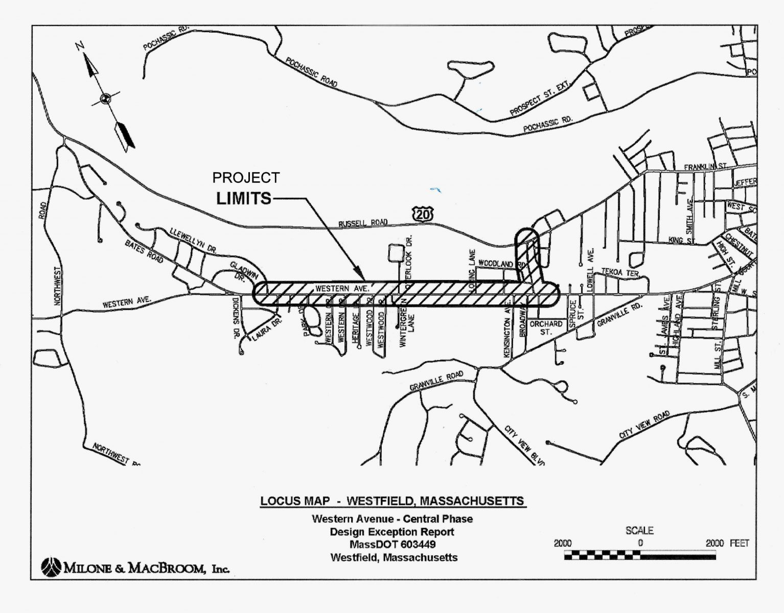
Rendering for the Central Phase of the project.
Brian Chapman, MassDOT project manager, said the plans are 25% complete at this time, and he anticipates the design to be completed by the spring of 2018. Chapman said that federal aid is paying for 80% of the $5.7 million project, and MassDOT the other 20%. He said the costs to the city will be $1.5 million.
Mark Arigoni, licensed landscape architect with Milone and MacBroom, who said he has been involved with the project for quite a long time, next went through each of the nine sections on a screen, before residents were asked for their input.
The project includes 10-foot travel lanes with 5-foot shoulders for the entire length of the Western Ave. portion of the project. There will be six exclusive left-hand turning lanes in key locations, and one right-hand turning lane, with islands shadowing some of the left-hand turn lanes; new crosswalks, a permanent traffic light at the entrance to the university, and a 10-foot wide hot mix asphalt multi-use path along the north side of Western Avenue, the entire project length. The multi-use path will connect to an 8-foot wide multi-use path the length of Lloyd’s Hill Road, which will also have left and right turning lanes onto Western Ave. There will also be a new 5-foot concrete sidewalk on the south side of Western Ave, and new pavement and new curbing the entire length of the project. 34 trees are slated to be removed, and 75 trees installed. The description of the proposed improvements is available for download on the Mass DOT website under Route 20 Access Improvement Project.
At the end of the presentation, Arigoni said that it was a milestone to get to this point.
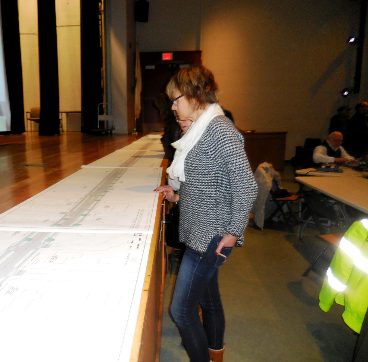
Residents look at project renderings before the public hearing began. (Photo by Amy Porter)
Rich Massey of MassDOT asked for comments, inviting elected officials to go first.
Many of the comments involved the 10-foot multi-use path on the northern side of Western Avenue. Ward 3 Councilor Andrew Surprise asked who would be responsible for snow removal on the path. Westfield city engineer Mark Cressotti said that the city’s law department has reviewed state and local ordinances, which require that homeowners clear a path through the shared use path.
Massey said that municipalities can make regulations to address that responsibility.
Mayor Brian P. Sullivan said there have been two different rulings by the law department, which have found that a movable path from one end to the other is required.
Sullivan then asked a different question about the multi-use path. “I’m wondering, this is the first time I’m seeing an 8-foot path from Western Ave to Lloyd’s Hill Road. Why can’t the Western Ave shared-use path be 8 foot? It would be more cost effective for one, and less of a burden, because it’s already 8 foot,” he said.
Massey responded that 10 foot is more desirable for a shared use path, and it’s wider where there is more room in the design.
“The concrete might be something we could retain and enhance the width. Given the college setting, concrete is something that might be acceptable,” Cressotti added.
Later during the comments, Ward 4 Councilor Mary O’Connell also weighed in, saying she would strongly support maintaining the beautiful concrete sidewalks in front of the university.
O’Connell also said she wanted to be reassured that no residents’ property would be permanently taken for the project. A MassDOT representative said the project involves 66 temporary easements for construction, which are the responsibility of the city to obtain. Property owners will retain the title. However, the representative added that the project is at 25% design plans, and at this time, involved no permanent easements.
Tom Smith of Holyoke, who has family in Westfield, asked about the grade of the path on Lloyd’s Hill Road, and whether it would need to have flat places to accommodate wheelchairs.
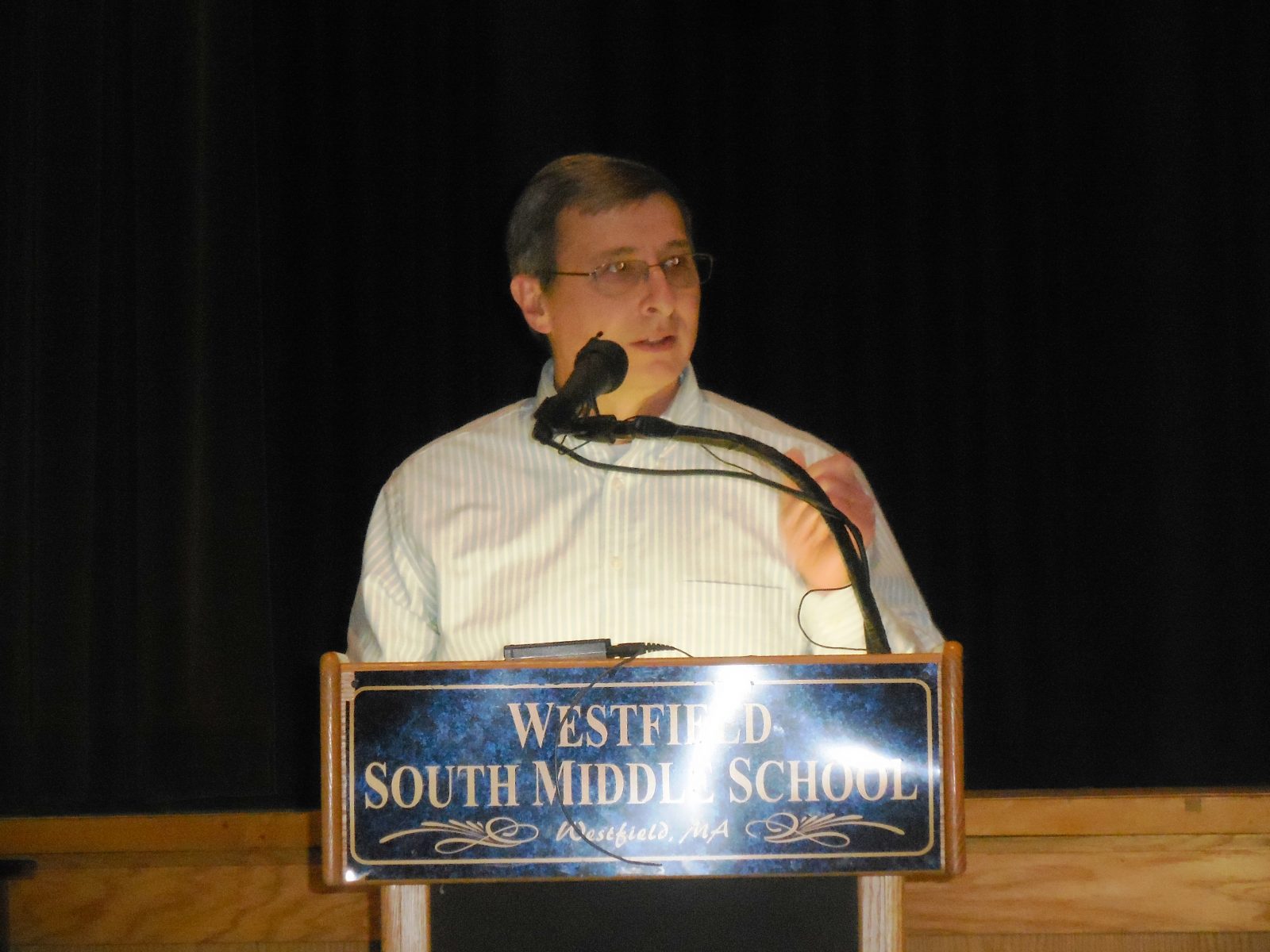
Rich Massey of MassDOT takes questions from audience at public hearing. (Photo by Amy Porter)
Arigoni responded that bikeway regulations are different than accessible ramp regulations, but that universal accessibility would be considered.
Other questions about Lloyd’s Hill Road involved the left-hand turning lane from Western Avenue onto the road, and whether there would be a signal installed. A base for the signal is in the project plans, but not the signal itself.
Arigoni said they are having discussions about what to do at the intersection, and about the entrance and exit from Broadway, which is a short distance to the west on the opposite side of Western Avenue from Lloyd’s Hill Road.
“I love this project, because as a runner, the cars that nearly hit me are not college students but people going to work,” commented resident Emma Hynes. She said her concern was that the design portion for Lloyd’s Hill would make the intersection more dangerous with a traffic light.
Other concerns expressed at the hearing involved the raised structures on Western Avenue. Resident Maureen Rodriguez asked who was going to take care of the islands, and got the answer that they will be the city’s responsibility to maintain.
Firefighter Joe Szenda said he goes to the university on a daily basis, and was concerned their multi-million dollar ladder truck won’t get by the raised structures. He said he was in favor of rumble strips.
Mark Cressotti responded that the roadway is 17 feet, including the 10 foot travel lane, 5 foot shoulder, and 2 foot buffer around islands.
Resident Bernie Rosenblum asked how snow plowers feel about islands in the road, to which Massey responded that it makes it more difficult, but it is a “trade off.”
Resident Frank Mills commented that the project would totally alter the neighborhood. He said that there are a lot of elderly people on Western Avenue that would have to clear the snow.
“It’s going to be tough. I don’t see this as an improvement, but the destruction of a neighborhood that I’ve lived in since 1956,” Mills said.
Cyclist Joe Giffune and runner Vanessa Diana on the other hand both complimented the project’s design. Giffune said he applauded the designers for giving more than the minimum space for the multi-use trail.
“Enthusiastic support for the planner,” Diana said, adding that she was happy to hear that the sidewalks will be redone on the Stanley Park side, where she said there is a lot of root damage. “Long overdue,” she added after the meeting.
All of the comments were included in the public record of the project. Additional statements and exhibits to be included may be submitted to Patricia A. Leavenworth, P.E., Chief Engineer, MassDOT, 10 Park Plaza, Boston, MA, 02216, Att: Roadway Project Management, Project File No. 603449, postmarked within 10 days of the hearing.
