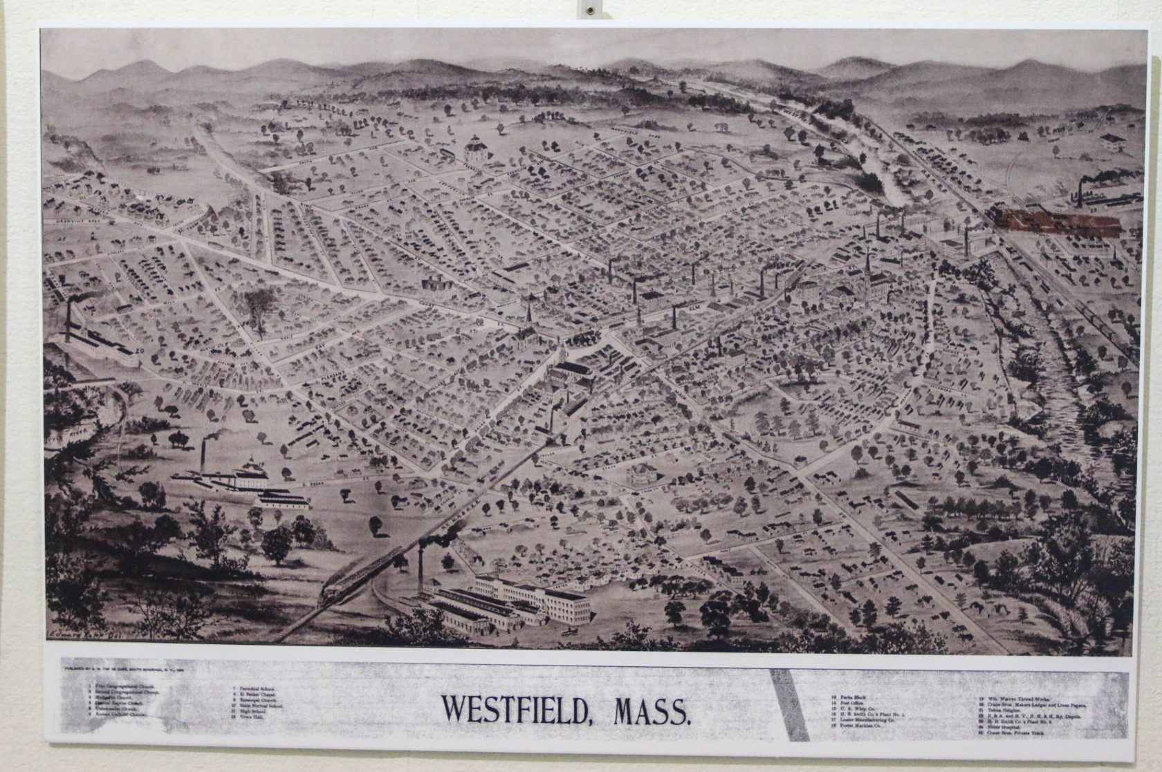
Bird’s eye view map of Westfield, one of 45 maps on display at the Westfield Athenaeum for one more week. (Photo by Kellie Adam)
WESTFIELD – Kate Deviny, acting director of The Westfield Athenaeum, wants residents of the Greater Westfield area to know that this is the last week to view the display of old and new maps at the library.
Deviny said the display of the 45 maps in the Jasper Rand Art Museum trace the history of Westfield from its roots in 1651 as a trading post for beaver skins to the present. The 1651 map also shows the settlements of the Dutch, Native inhabitants and the French in the city.
Other maps of Westfield are from the railroad and businesses, and others show the topography of the land, plus a bird’s eye view of the city.
“A lot of the maps, people have not seen before,” Deviny said of the exhibit, which has been on display since May and is coming down at the end of June. Afterwards, all of the maps will live in the Reference Department, she said.
Besides maps of Westfield, there are United States maps that show the progression of the states in the continental U.S. over the years from the Atlantic to Mexico and to Louisiana. There are also maps of the British forts.
Deviny said during the Westfield 350 celebration, a lot of people visited the library and viewed the display. She wanted to make sure those residents who haven’t yet, have an opportunity to do so before they come down.
The next display will be of the music makers of Westfield, going back to the 1800’s. She said that display, which will be enclosed in glass cases in the reading room, features among others Ben Chadwick the Singing Policeman. Chadwick wrote his own music, including the song for the Agricultural College (now UMASS Amherst) entitled “The Sons of Old Massachusetts.”