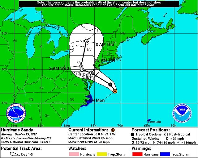
 WESTFIELD – Local officials continued to prepare for the impacts of Hurricane Sandy earlier today, but with a certain degree of optimism that the city is positioned to weather the storm of historically massive size.
“This is one of those things where real-life events have tested our mettle,” Mayor Daniel M. Knapik said this morning. “Mother Nature threw everything at us last year, so we are in far better shape. We really ran the gauntlet last year, so we know from experience what we need to do.”
“We’re down to the nitty gritty activities getting ready,” Knapik said. “We have crews taking down the plants hanging along roads today. So there is not much more that we can do except wait.”
Knapik said that school was cancelled for today and that a decision on the school day for tomorrow will be made later today as the hurricane moves ashore and the impacts are felt locally.
“The School Department has checked and activated generators in case we have to open shelters in the school,” Knapik said. “The Senior Citizen Center is closed today but staffed in case seniors need assistance. They can reach the staff at 562-6435 and meals will be delivered an hour earlier than usual. Trash is being collected and we’ll make a decision on the Tuesday routes this afternoon.”
“The good news is that the Westfield River is very low and the expected rainfall from the storm is not a big threat,” Knapik said.
Westfield Emergency Management Director Jim Wiggs said this morning that Sandy is more of a wind threat than a flooding threat.
“We haven’t had a lot of rainfall recently like we did the week before Irene, so the ground is not saturated and will absorb a lot more water,” Wigs said. “The level of the Westfield River is at four feet now, last year for Irene it was more than seven feet high and the flood control dams upstream have more impound capacity than last year.
“We’re anticipating much less rainfall from Sandy, between two and four inches, so this will be more of a wind storm,” he said. “We are urging residents to remove or secure anything that could become a wind-borne projectile, lawn furniture, campaign signs, decorations…”
Wiggs said the city is prepared to open shelters, but is coordinating with the American Red Cross which is opening regional shelters in each county of western Massachusetts.
“We still not have opened a shelter, so if the numbers of people displaced by this storm are low, we’ll use the regional Red Cross shelters.”
The storm is expected to create high winds which could cause significant damage to trees, especially further south, which are still in full foliage. The high winds are expected to cause extensive power outages.
Knapik said the city has continued to improve its flood control system, replacing pumps.
“We’ve been checking out the levees and testing the flood control system where we have upgraded facilities and pumps,” Knapik said Friday. “The Water Department has acquired five trailer-mounted generators that we can move around the city as needed. This will also be the first ‘all hands on deck’ event for the emergency communications dispatch department.”
Wiggs said that residents should also prepare for the storm by taking steps before Sandy hits the eastern coast.
Fuel vehicles, fuel and test generators, fill propane tanks in case you have to cook without electrical power, test flashlights and batteries, get a stock of water and nonperishable foodstuffs. Charge cell phones and other electronics before the storm, and use banks or ATMs to get a emergency cash reserve.
Residents in flood prone areas should prepare in the event they need to evacuate their homes, packing with medication, personal documents, a week’s worth of diapers and baby formula for families with infants, some form of entertainment for older children who may have a stay in a shelter, as well as clothing and toiletries.
To see this morning’s video forecast from the National Hurricane Center, click here.


