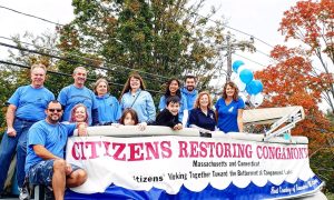
WESTFIELD- This weekend’s festivities will bring out the city’s residents to celebrate Westfield’s 350th birthday. Because of all of the events and the parade itself on Sunday, normal traffic flow and parking locations will be changed.
Westfield State University has opted to not allow parking for the parade in the campus’ commuter lot. However, the Second Congregational Church, located between the main campus and Stanley Park on Western Avenue, will allow marchers to park there. Parade participants should keep in mind that the church’s parking lot is smaller than the commuter lot and will not be able to fit every single person marching in the parade.
Parking is also available at Westfield Middle School and Amelia Park. Six shuttle buses will be available to bring marchers from those parking lots to the staging areas at Stanley Park from 10 a.m. to noon, according to Paul Nunez, a board member of the Friends of the Westfield 350. City officials are encouraging everyone to walk instead of drive during the weekend whenever possible.
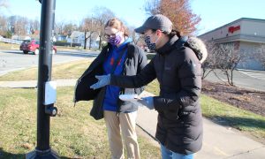
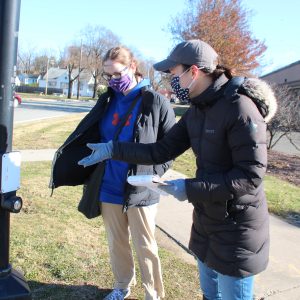
On Saturday night during the fireworks and related events at Westfield Middle School and Amelia Park there will be designated parking areas as well. Director of Community Development Peter Miller said there could be as many as 4,000 people at the fireworks, if not more. Due to the anticipated high volume of vehicle and foot traffic, the area will be much harder to navigate than an average Saturday night.
“Due to the scale of the event, we have worked hard to build a public safety plan to ensure that pedestrians and drivers reach the event safely,” said Miller, “We are encouraging people to take advantage of this more central location by walking to the fireworks, either through the city’s surface streets and sidewalks or by the Columbia Greenway Rail Trail. We hope these alternatives will limit the number of cars that choose to drive directly to South Middle School.”
The designated parking locations for the fireworks are: Westfield Middle School, the Amelia Park complex parking lots, the Abner Gibbs School parking lot, the Westfield Senior Center, City Hall, and any municipal parking lots in the downtown area. Miller added that any privately owned lots can allow public parking at the owner’s risk.
Beginning Saturday at 7 a.m., the portion of Elm Street between Franklin and School streets will be shut down by the traffic bureau for the road race and the following festivities. That section of Elm Street will remain closed until the conclusion of the parade on Sunday sometime between 5 and 6 p.m.. Those who would normally have gone through Elm Street will be required to use Mechanic Street and Meadow Street, or Franklin and WashingtonsStreets to avoid the closure.
The Run Westfield Flat Fast 5k race begins at 1p.m. at Westfield State University’s South Lot. The race route will take runners down the length of Western Avenue to Court Street. Participants will then go to the Westbound lane of Court Street at Washington Street before turning at the library towards School Street, where the race will end. The entirety of the race route and the side streets along it will be closed off at approximately 12:45 p.m.. As the race goes on and the last runners push through, portions of Western Avenue will be reopened until the last runners are within the closed part of Elm Street. School Street will remain open during the festivities, but it may be shut down occasionally during the race.
On Saturday, near the start of the fireworks at 9:15 p.m., a portion of West Silver Street will be shut down from Broad Street to Pleasant Street. That section will reopen when most of the pedestrian traffic has cleared from the area, which is estimated to be somewhere between 10:15 and 10:30 p.m..
On Sunday, the actual day Westfield was incorporated, there will be the parade. The parade will begin at 1 p.m., although city officials said they expect heavier traffic at 11 a.m. in the area of Stanley park where the parade begins. The entire parade route will be shut down at 12:30 p.m. The route begins on Western Avenue at Kensington Avenue and will continue east towards Court Street. When the parade gets to Washington Street, the route will shift entirely into the Westbound lane and continue to turn at the library onto Elm Street. The parade ends when participants cross School Street into the closed part of Elm Street. School Street will also be closed for the duration of the parade.
City officials estimate that the parade will end sometime around 4:15 p.m.. It will be followed by a performance by the Mummers, the final parade contingent. Elm Street should be reopened between 5 and 6 p.m..
A list of possible detour routes wasreleased by Mayor Brian P. Sullivan for those who need to travel throughout the city by car during the parade.
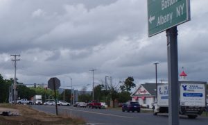
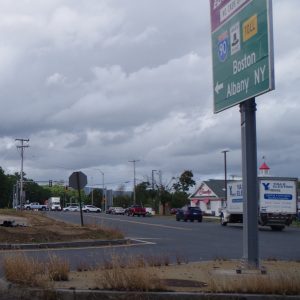
For those coming from the north, in the area around the Mass Pike, to any area south of Court Street and Western Avenue or traveling east on Route 202 will be directed to take Meadow Street to Mechanic or Main Street, depending on their destination. Those continuing south on Routes 10 and 202 will be directed to use Broad Street to West Silver Street to South Maple Street to continue further south. Any motorists travelling westbound will be unaffected and can take Franklin Street (Route 20 west).
Those traveling from the south, near the Southwick line along Routes 10 and 202 north can take a right turn on West Silver Street and turn left on Broad Street, then Main Street where signs will direct them to use Mechanic Street to any destinations north or west. Motorists travelling north to continue west on Route 20 will take Meadow Street to Union Avenue and turn/U-turn at Pochassic Road or the 911 Memorial to head back southbound to Elm Street to access Route 20 west.
Motorists traveling east near the border of West Springfield heading north should follow the signs directing them from Meadow Street and Union Avenue to North Elm Street. Those heading south will have to use Broad Street and go to West Silver Street and then South Maple Street. Motorists going west will also take Meadow Street and Union Avenue to turn onto Pochassic Road or the 9/11 Memorial to go back son Elm Street to get to Route 20 west.